Banjar Nyuh
Most useful arrival zone for west routes and Toyapakeh stays.

More than a day trip
Plan at least 3D2N. Pick nearby stops for each day and leave room for the journeys between them.
Route clusters
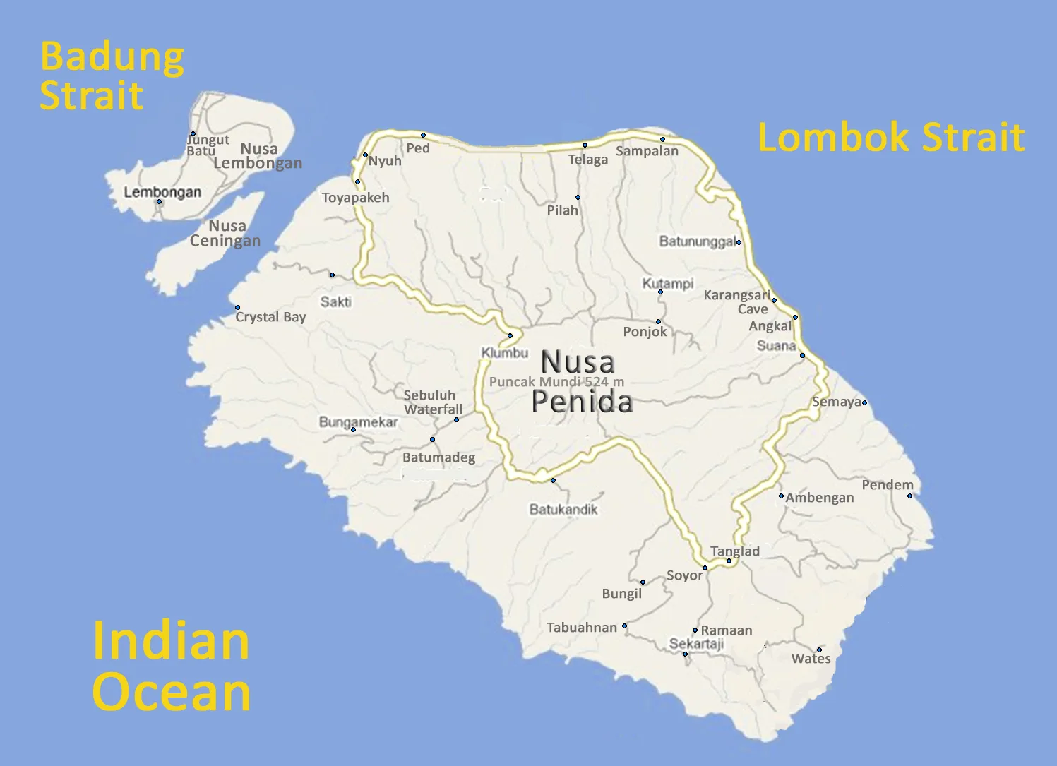
Use the plotted pins for route orientation, then open the matching guide or live navigation link from the cards below.
Most useful arrival zone for west routes and Toyapakeh stays.
Practical for boat arrivals, snorkeling departures, and short stays.
A slower west-side beach base; strongest for sunset and an overnight reset.
The west route anchor; allow time for parking, heat, crowds, and viewpoints.
Pair with Angel’s Billabong, not with an overloaded whole-island plan.
Balanced north-coast base with dining and marine-trip access.
Useful for north-coast services and an earlier start toward the east.
A cultural east-route stop; respectful clothing and conduct are essential.
East-coast anchor; choose one major beach descent rather than both.
Optional inland stop when it fits the return direction and daylight.
Boat-only marine stop; sightings and departures depend on conditions.
Route-time matrix
Kelingking and Diamond Beach in one day turn the trip into a cross-island transfer. Add a same-day Bali boat and the visit becomes even more fragile.
Method, reviewed 20 September 2026: These are conservative editorial planning ranges based on route distance, road complexity, and stop logistics. They do not represent live traffic or a guaranteed transfer time. They remain pending a documented field-timing audit. Confirm the day’s route with a local driver or live navigation.
Start at 3D2N
Choose how much room you want for west, east, marine conditions, and recovery. Your answer stays in this browser and creates no indexable filter page.