
Image sources
Photo Credits
Sources, creators, and reuse licenses for the locally hosted travel photographs used across Visit Penida.
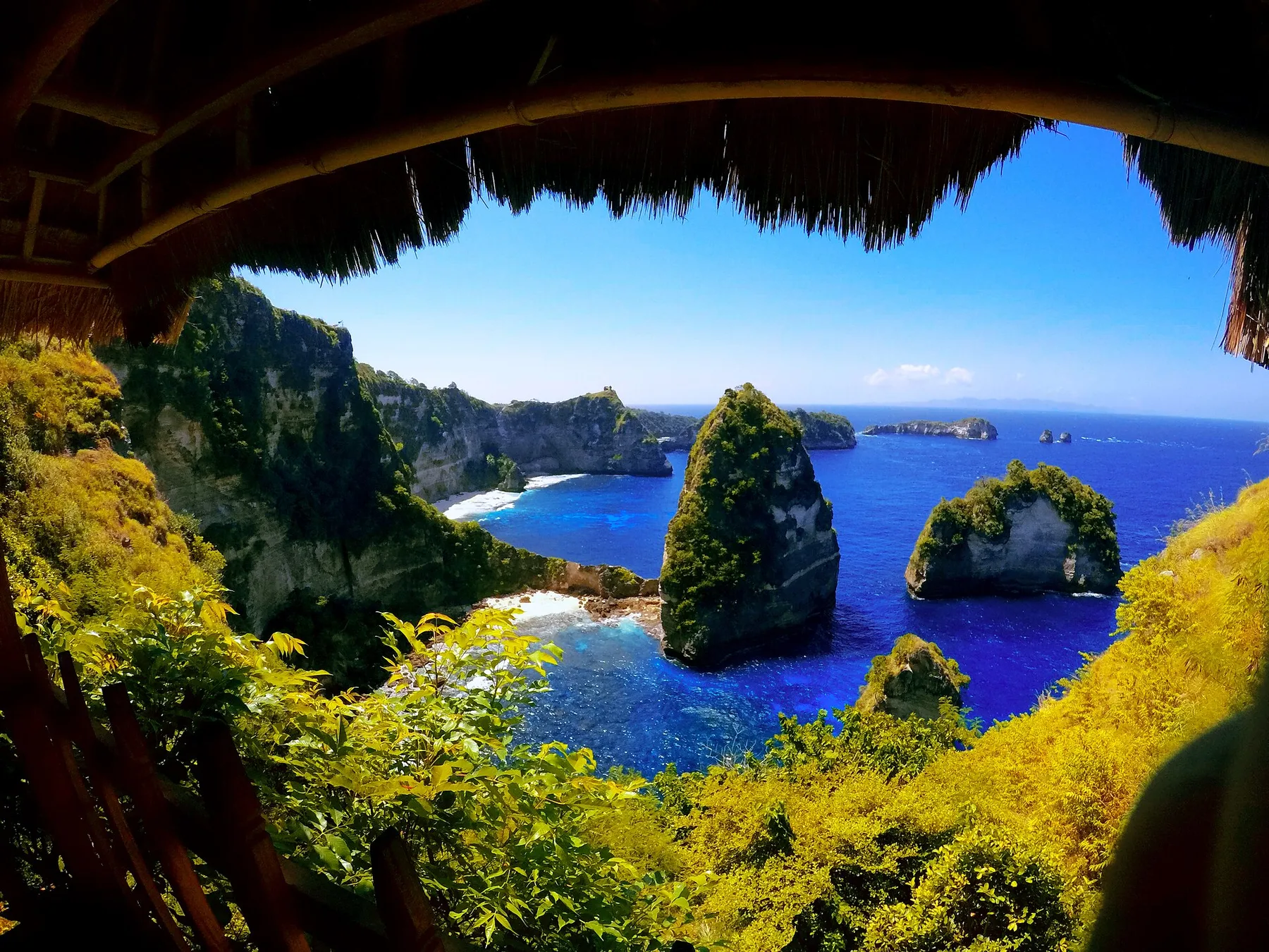
Visual guide
Photo Credits in context
Real, credited travel photography selected to explain the route, area, or experience.
Every editorial photo is registered with a local file, useful alt text, caption, creator, source URL, license, and original dimensions. Responsive AVIF and WebP versions are generated locally for faster delivery.
Licensed travel photography
Most location images come from Wikimedia Commons under the license shown below. Cropping and format conversion may be applied for responsive delivery.
Authorized Mahaloka media
Mahaloka Valley property, room, Crystal Bay, and Starlink photographs come from its official media library and are used in relevant property contexts.
-
Angel's Billabong on Nusa Penida's west coast.
Natural tidal pool and rugged rock shelf at Angel's Billabong
Photo by Georgi Kovachev. Source file · CC BY-SA 4.0
-
Atuh Beach is best grouped with the east-coast route.
Atuh Beach and its limestone coastline in east Nusa Penida
Photo by Hendrojkson. Source file · CC BY-SA 4.0
-
Boat routes and arrival harbours should be confirmed before booking an island transfer.
Passenger boat traveling toward Nusa Penida
Photo by JyotiPN. Source file · CC BY-SA 4.0
-
Broken Beach is a natural west-coast pairing with Angel’s Billabong.
Natural rock arch and circular cove at Broken Beach
Photo by Aaron Rentfrew. Source file · CC BY-SA 4.0
-
Buyuk Harbour serves the north-coast side of Nusa Penida.
Boats and shoreline at Buyuk Harbour in Nusa Penida
Photo by Magul. Source file · CC BY-SA 4.0
-
Confirm the exact arrival harbour because Buyuk, Banjar Nyuh, and Sampalan affect onward travel.
Boats and harbour activity at Buyuk on Nusa Penida
Photo by Magul. Source file · CC BY-SA 4.0
-
Crystal Bay changes character between the busy middle of the day and quieter evenings.
Shoreline and boats at Crystal Bay
Photo by Magul. Source file · CC BY-SA 4.0
-
Crystal Bay is a west-side beach and sunset base.
Crystal Bay beach, boats, and offshore island in Nusa Penida
Photo by Magul. Source file · CC BY-SA 4.0
-
Diamond Beach is an east-coast viewpoint with an optional steep descent.
Diamond Beach beneath the limestone cliffs of east Nusa Penida
Photo by Stryn. Source file · CC BY-SA 4.0
-
Gili transfers depend on operator route, sea conditions, and the Penida departure point.
Passengers boarding a boat connection in the Gili Islands
Photo by Mansu Mon. Source file · CC BY-SA 4.0
-
Goa Giri Putri is an active sacred site; respectful dress and conduct matter.
Temple area inside Goa Giri Putri cave in Nusa Penida
Photo by Sasuke shinozawa. Source file · CC BY-SA 4.0
-
Illustrative accommodation context; not a photograph of the named property.
Illustrative infinity pool setting in Bali
Photo by Sean McGrath. Source file · CC BY 2.0
-
Illustrative accommodation context; not a photograph of the named property.
Illustrative private pool pavilion in Bali
Photo by Matt @ PEK. Source file · CC BY-SA 2.0
-
Illustrative accommodation context; verify the actual property facilities directly.
Illustrative villa pool setting in Bali
Photo by Matt @ PEK. Source file · CC BY-SA 2.0
-
Illustrative Balinese dining context; menus and presentation vary by restaurant.
Illustrative spread of Balinese dishes
Photo by Yun Huang Yong. Source file · CC BY 2.0
-
Illustrative Balinese food context; check the current menu directly.
Illustrative Balinese fried duck dish
Photo by Midori. Source file · CC BY 3.0
-
Illustrative cafe context; not a photograph of the named business.
Illustrative open-air cafe in Bali
Photo by Sasha India. Source file · CC BY 2.0
-
Illustrative dining context; verify the venue atmosphere and menu directly.
Illustrative open-air restaurant setting in Bali
Photo by Shoestring. Source file · CC BY-SA 1.0
-
Inter-island transfers between Lembongan and Penida use small local boats and changing departure points.
Traditional boat beside the mangroves of Nusa Lembongan
Photo by Wikivoyage member Burmesedays. Source file · CC BY-SA 4.0
-
Keep distance from marine life and follow your guide’s instructions.
Sea turtle swimming in the waters around Nusa Penida
Photo by stef bemba. Source file · CC BY 2.0
-
Kelingking is the headline viewpoint on the west-side route.
Kelingking Beach and its T-Rex-shaped limestone headland
Photo by Shrigusti. Source file · CC BY-SA 4.0
-
Kusamba is an east-Bali departure area; confirm the operator and exact beach harbour.
Black-sand coast and traditional activity at Kusamba in east Bali
Photo by Juan Antonio Segal. Source file · CC BY 2.0
-
Manta sightings are never guaranteed and sea conditions decide whether a trip can run.
Manta ray swimming at Manta Point near Nusa Penida
Photo by Andrepiazza. Source file · CC BY-SA 3.0
-
Mola mola encounters are seasonal wildlife experiences and never guaranteed.
Mola mola sunfish underwater at Crystal Bay
Photo by Roland Unger. Source file · CC BY-SA 3.0
-
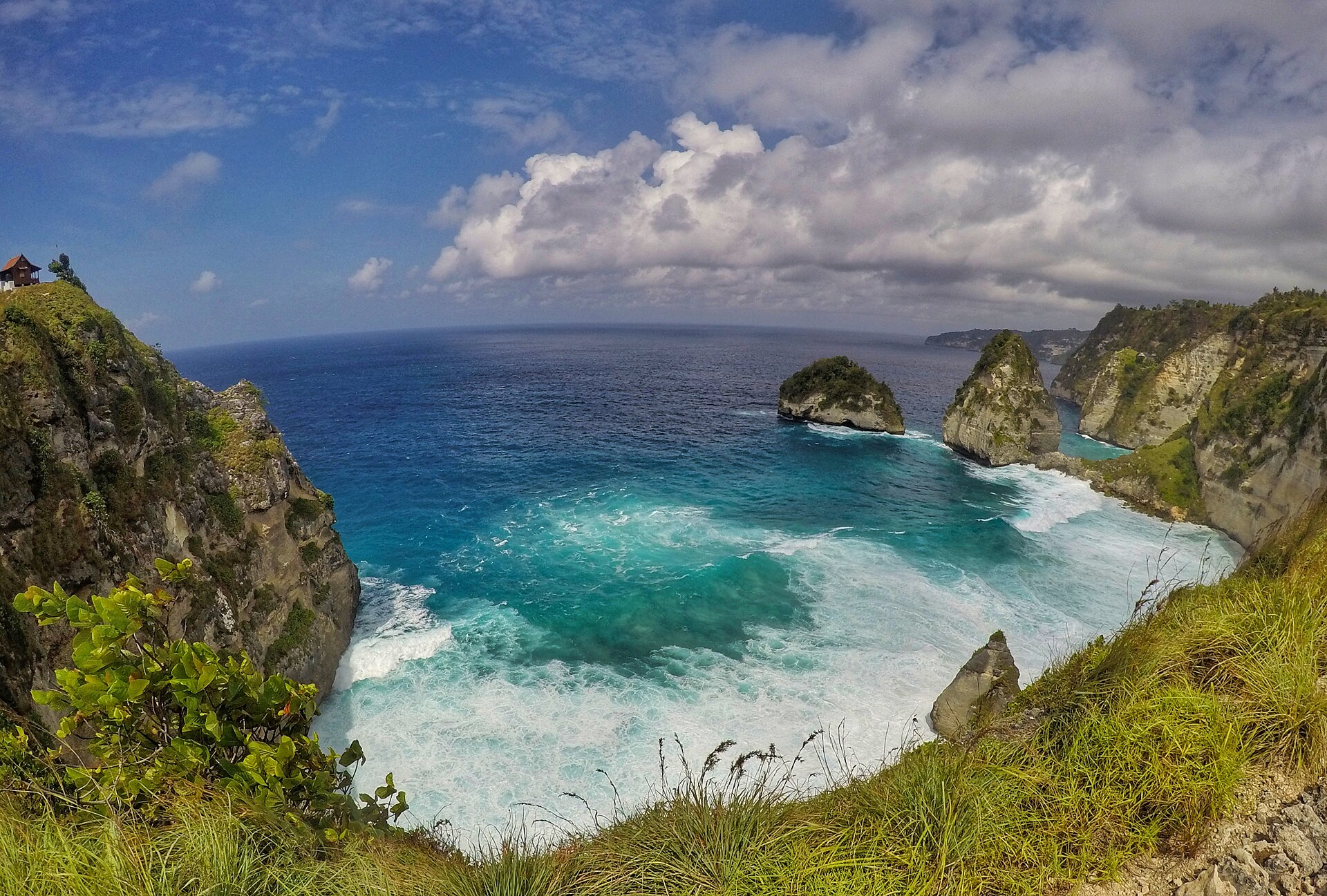
Nusa Penida is larger and slower to cross than it first appears on a map.
Limestone coast and offshore rock formations around Nusa Penida
Photo by Deaamannda. Source file · CC BY-SA 4.0
-
Official Mahaloka Valley Resort connectivity image.
Starlink equipment at Mahaloka Valley Resort
Photo by Mahaloka Valley Resort. Source file · Official media library
-
Official Mahaloka Valley Resort media showing nearby Crystal Bay.
Crystal Bay beach near Mahaloka Valley Resort
Photo by Mahaloka Valley Resort. Source file · Official media library
-
Official Mahaloka Valley Resort media.
Pool and tropical bungalows at Mahaloka Valley Resort
Photo by Mahaloka Valley Resort. Source file · Official media library
-
Official Mahaloka Valley Resort room image.
Deluxe queen bungalow interior at Mahaloka Valley Resort
Photo by Mahaloka Valley Resort. Source file · Official media library
-
Padang Bai serves vehicle ferry and selected passenger connections; schedules should be reconfirmed.
Coast and harbour area at Padang Bai in east Bali
Photo by Oliver Spalt. Source file · CC BY 2.0
-
Reef stops should be chosen around current swell, current, and operator advice.
Clear water at a snorkeling site around Nusa Penida
Photo by brian. Source file · CC BY 2.0
-
Reef visibility and current vary; choose a responsible operator and follow the guide.
Coral reef underwater around Nusa Penida
Photo by NileGuide.com. Source file · CC BY 2.0
-
Remote Penida beaches can involve difficult roads, steep access, and changing sea conditions.
Tropical beach beneath limestone cliffs in Nusa Penida
Photo by Tiket2. Source file · CC BY 2.0
-
Rumah Pohon is reached as part of the Thousand Islands viewpoint area.
Rumah Pohon tree house above the east Nusa Penida coastline
Photo by Dini Rosyadah Tridya. Source file · CC BY-SA 4.0
-
Sanur is the most common Bali departure point for passenger fast boats.
Fast boats lined up at Sanur harbour for Nusa Penida crossings
Photo by Imadedana. Source file · CC BY-SA 4.0
-
Southwest Penida viewpoints involve slower local roads and exposed cliff terrain.
Cliff and ocean view from Banah Sunset Point in Nusa Penida
Photo by M. Abdallatif. Source file · CC BY-SA 4.0
-
The cliff-top view is worthwhile even when the beach descent is not suitable.
White-sand Diamond Beach seen from the east-coast cliffs
Photo by MartinThoma. Source file · CC0
-
The island interior is hilly, rural, and slower to cross than the coastline suggests.
Green limestone landscape across Nusa Penida
Photo by Haryanti. Source file · CC BY-SA 4.0
-
The north coast contains several separate harbour areas; use the ticket’s exact arrival name.
Pier and lighthouse on the north coast of Nusa Penida
Photo by Chainwit.. Source file · CC BY 4.0
-
The Peguyangan route involves a long exposed stairway and should not be treated as an easy waterfall stop.
Blue stairway descending the cliff at Guyangan or Peguyangan
Photo by patargogo. Source file · CC BY 3.0
-
Toyapakeh and Banjar Nyuh form the island’s most practical arrival zone for many visitors.
Lighthouse and coastline at Toyapakeh, Nusa Penida
Photo by Eka343. Source file · CC BY-SA 4.0
-
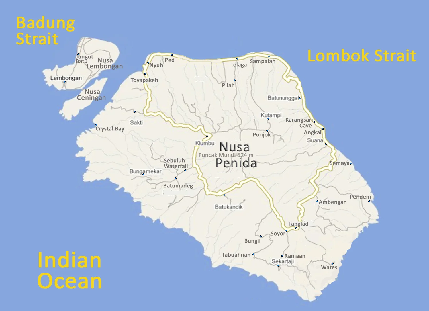
Use the map to group stops by west, east, north coast, and marine routes.
Map showing the main areas, roads, and coastline of Nusa Penida
Photo by Wikivoyage member Burmesedays. Source file · CC BY-SA 4.0


.jpg)
.jpg)
.jpg)
.jpg)


_(1365818884).jpg)
.jpg)
.jpg)


_(50367978613).jpg)


.jpg)
-APiazza.JPG)
-APiazza_cropped.jpg)


_-_img_01.jpg)


